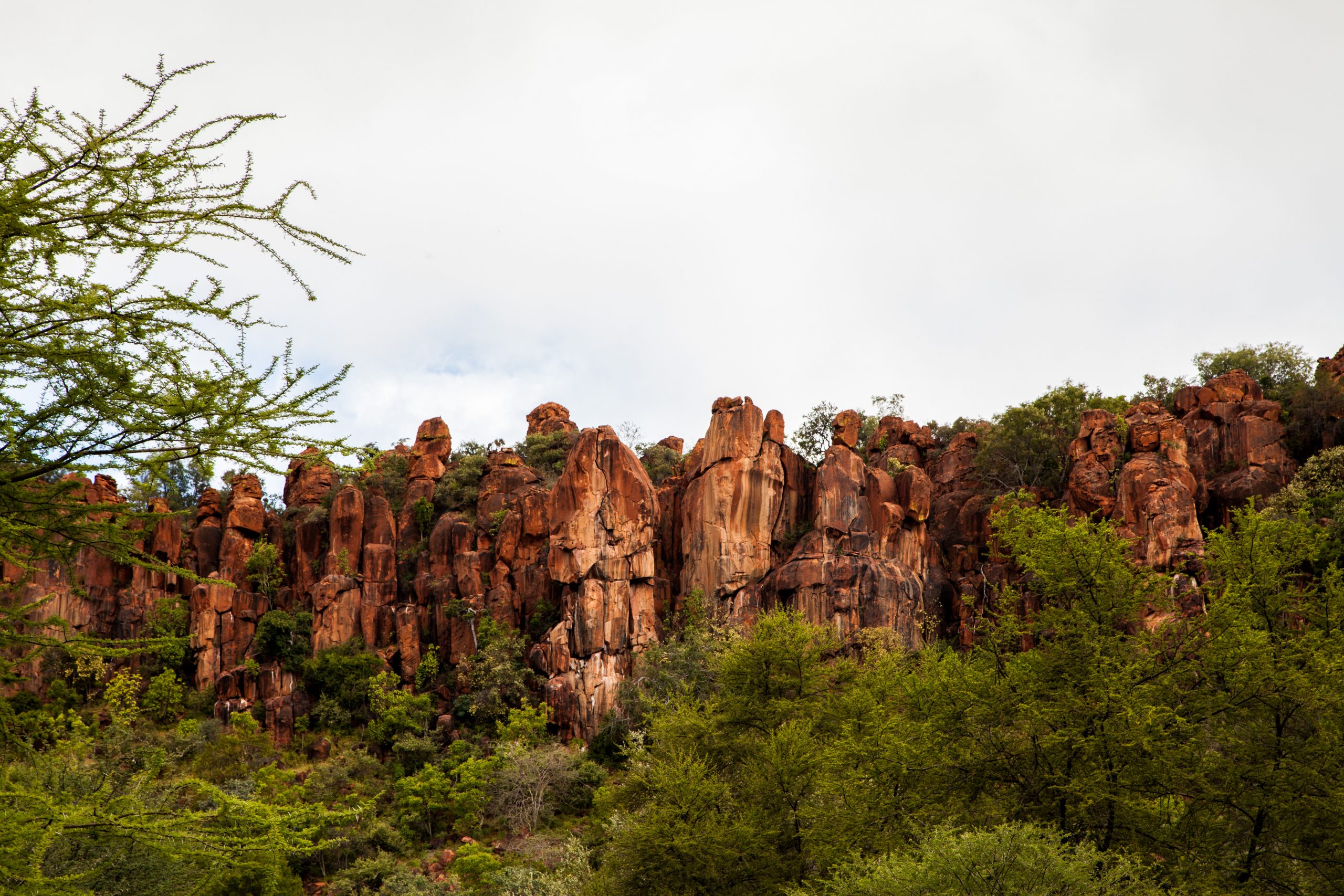
An island of colour and conservation
Rising as an island of colour some 200 metres above the surrounding African bush and savannah, the Waterberg Plateau, with its flamboyant brick-red sandstone formations and lush green vegetation, is without a doubt the main drawcard of the region. Other attractions are the Hoba Meteorite, the Otjihaenamaparero dinosaur footprints and the Dragon’s Breath underground lake. Tsumkwe, the administrative centre of Bushmanland is home to a large San population, and the southern gateway to the Khaudum National Park.
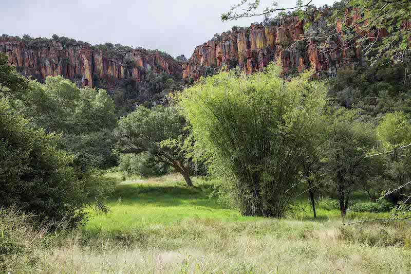
The Waterberg Plateau Park of today is home to some 25 game and over 200 bird species.
WATERBERG PLATEAU PARK
The 405 km2 Waterberg Plateau Park was proclaimed in 1972 as a reserve for endangered and protected species. The history of the park began on 15 June 1956 with the declaration of
two portions of the plateau as natural monuments. This came to pass after representations were made to the then SWA Administration by the Kameradschaft Ehemaliger Deutscher Soldaten, members of the Scientific Society, the Monuments Commission, and other interested parties. The two areas – the Omuverume Plateau and the Karakuwisa Mountain Range – were, however, divided by farms that had been allocated to farmers in the past. The Omuverume Plateau is probably the only sandveld vegetation type that developed for many centuries without being disturbed, due to the vertical cliffs and flora there having reached a unique stage of climate development. Interestingly enough, the original motivation for the proclamation of the entire Waterberg Plateau as a park was to create a reserve for eland. It was reasoned that there are about 800 eland in the Waterberg area that move from farm to farm and cause a nuisance. As soon as the farmers obtain ownership of the game on their land, the future of these eland will be in jeopardy because the farmers do not tolerate eland on their land. How wrong this statement proved to be! It was only when farmers were granted ownership of their game, that game populations in the country began to flourish and increase.
The Waterberg Plateau Park of today is home to some 25 game and over 200 bird species. Rare species such as roan and sable antelope, Cape buffalo and tsessebe occur in large numbers.
Species such as black and white rhino are also firmly established on the plateau. The vegetation changes dramatically from acacia savannah at the foot of the plateau to lush green sub-tropical dry woodland with tall trees and grassy plains at the top. Ten fern species have been recorded at the Waterberg, of which one is endemic to Namibia and Angola. There is also an impressive range of flowering plants, including the conspicuous flame lily, Gloriosa superba.
On the site of the historic Battle of Waterberg, at the foot of the plateau, a graveyard serves as a reminder of a turbulent period in history. Schutztruppe soldiers who died in the battle fought between the Herero and German colonial forces in 1904 are buried here.
At the eastern extremity of the park is the Okatjikona Environmental Education Centre, a facility run by the Ministry of Environment, Forestry and Tourism that provides the opportunity for visiting groups, mainly schoolchildren, to learn about the importance of environmental conservation.
The superb natural beauty of the Waterberg can be enjoyed by vehicle on a guided game-viewing tour conducted by NWR or easy walking routes along the base of the plateau.
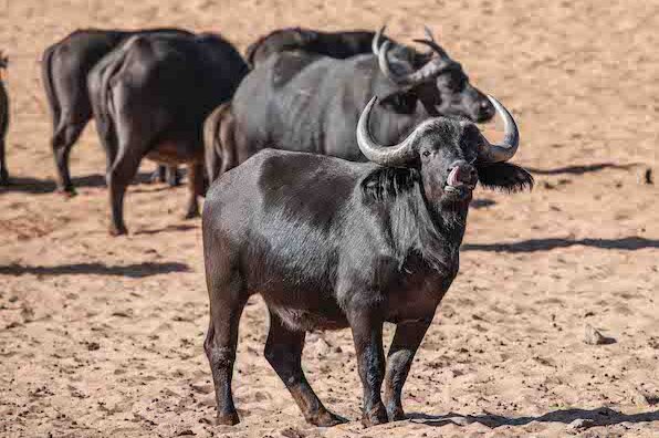
African buffalo in the Waterberg National Park
HOBA METEORITE
The largest known meteorite of its kind in the world, Hoba Meteorite, lies in a shallow depression on the farm Hoba-West, about 20 km west of Grootfontein. The 50-tonne mass of iron and nickel is between 100 to 300 million years old. It crashed into earth some 30 000 to 80 000 years ago. Discovered by Jacobus Hermanus Brits in the 1920s, it has periodically been subjected to vandalism.
Measures to protect the meteorite were taken in the 1980s in a joint venture between Rössing Uranium Ltd and the National Monuments Council. A stone amphitheatre was built around it to allow for convenient viewing, with a museum wall at the entrance displaying information about the meteorite. An interesting variety of birds such as Kalahari Scrub Robins and several species of waxbills inhabit the surroundings, and there are barbecue facilities at the site.
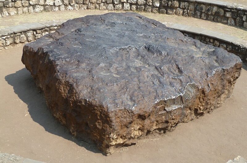
The Hoba Meteorite is the largest known meteorite in the world.
DINOSAUR FOOTPRINTS & DRAGON’S BREATH CAVE
Tracks of a two-legged, three-toed dinosaur can be viewed 29 km north of the town of Kalkveld on the farm Otjihaenamaparero. The cluster of small, shallow indentations in the rock surface – declared a national monument in 1951 – is estimated to be 150 million to 185 million years old. Visitors are required to pay a fee, and overnight and picnic facilities are provided on the farm.
On the farm Harasib, 46 km northwest of Grootfontein off the C42 to Tsumeb, is the world’s largest known underground lake. It lies about 60 metres below ground level in a cave referred to as Dragon’s Breath, an enormous cavern of solid rock accessed from above using ropes and caving equipment. The lake has crystal-clear water and a surface area of almost two hectares. It is currently accessible only to professional cavers and divers. On the same property is Harasib Lake, where a group of cave divers, reaching depths of 147 metres in July 2012, set a new record. Though an interesting feature of the area, Dragon’s Breath is unfortunately not open to the public.
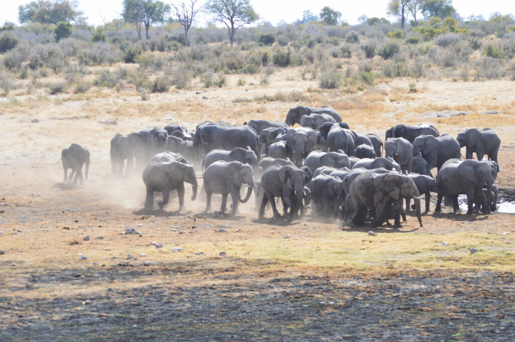
Khaudum is characterised by its bushland wilderness areas, teeming with wildlife, perfect for the true adventurer.
KHAUDUM NATIONAL PARK
Khaudum National Park is a densely wooded wilderness reserve that borders Botswana in the east and can be explored only in 4×4 vehicles. It is the only conservation area in Namibia where the northern Kalahari sandveld biome is protected. The Khaudum Game Park was proclaimed in 1989. In February 2007, the 3 842 km2 reserve was given national park status and its name was adapted accordingly.
The wilderness harbours several big game species and a multitude of birds. However, as a result of the dense vegetation, game viewing in the Khaudum requires considerable patience. Large animals found throughout the park are elephant and giraffe, while predators are lion, leopard,spotted hyaena, and side-striped and black-backed jackal.
African wild dogs also occur here. Game numbers vary considerably, as Khaudum is largely unfenced, enabling the animals to follow their natural migration routes. Khaudum is the stronghold of Namibia’s roan antelope. Other animals seen here are kudu, steenbok, gemsbok and blue wildebeest, while tsessebe, hartebeest, eland and reedbuck occur in the central areas. About 320 bird species have been recorded at Khaudum. Rare species include Coppery-tailed and Senegal Coucals, Bradfield’s Hornbills, Rufous-bellied Tits, Black-faced Babblers and Sharptailed Starlings.
Please note: A minimum of two 4×4 vehicles per group are required to travel in the park. There are two campsites in the park: Khaudum in the north and Sikereti which has been upgraded. You are advised to bring your own water, wood, fuel and provisions. Fuel is only available at Bagani, Divundu and Rundu in the Kavango East region to the north of the park.
The small town of Grootfontein serves the surrounding cattle-ranching community and is the last urban centre on the road to Rundu and the far northeast. Its history and character are personified in its coat of arms by depictions of the Hoba Meteorite, a palm tree, kudu, eland and cheetah. The Herero name of the town – Otjiwanda Tjongue – means leopard’s crest, and these secretive, nocturnal cats still occur in the surroundings. Due to the relatively high rainfall and large number of springs in the area, the San and Damara who lived here during the first half of the 19th century called the place Gei-/ous, which translates as Grootfontein (Afrikaans for large spring).
A historic fort from the German era, built in 1896, houses the Grootfontein Museum with its extensive mineralogical collection, ethnical display – including an extensive exhibition on the Himbas – implements for making ox wagons, utensils used in the Kavango Region and an exhibition featuring the German colonial Schutztruppe. The museum celebrated its 30th year in 2013. It hosts an annual Christmas market on the last weekend of November, as well as movie nights throughout the year. Housed in the same building in Eriksson Street is the Tourist Information Centre. Close by is the fountain that gave rise to the town’s name, encircled by the Tree Park with its collection of exotic trees.
Providing a break from fast foods, Coffee Bloom in Hidipo Hamutenya Street serves balanced, home-cooked meals, cakes and light refreshments, and sells small gifts and jewellery.
Situated in the Grootfontein district, northeast of the homestead of the farm Keibib, is a large baobab tree that was declared a national monument because it was regarded as the largest of its kind in the commercial farming area. On the farm Rietfontein is the grave of Axel W Eriksson, well-known traveller, hunter and pioneer in South West Africa during the second half of the 19th century.
Grootfontein Museum/ Tourist Information Centre Tel (+264 67) 24 2456
The small towns of Otavi, Grootfontein and Tsumeb demarcate the so-called Maize Triangle, a relatively high-rainfall area with a flourishing agriculture sector centred mainly around the cultivation of maize and lucerne, some of which is under irrigation. While the town itself doesn’t offer much in terms of tourist attractions, the surroundings do.
The Khorab Memorial – about 3 km from Otavi and dating back to the First World War – marks the spot where a ceasefire was signed at Khorab on 9 July, 1915.
On the farm Ghaub, 35 km northeast of Otavi, a historical mission station built in 1895 was converted into Guest Farm Ghaub. There is much of interest in the surroundings, including the Ghaub Caves, remarkable for their stalactites, and San paintings, which have been declared a national monument. The Fourways Stopover at the intersection leading to Tsumeb and Grootfontein hosts a petrol station, car wash, biltong shop and butchery, takeaway outlet, chicken-and-chips shop, pizzeria, fresh vegetable market, and a small nursery. There are also braai facilities for truckers, and the Camel Inn Restaurant and Bar, which is open seven days a week for breakfast, lunch and dinner.
The town of Otjiwarongo, a Herero word meaning ‘a good place’, is an important centre for cattle ranching. It is situated about 250 km north of Windhoek, on a slope amid undulating plains.
The Otjiwarongo Crocodile Farm, where you can get close-up views of crocodiles of various ages, is well worth a visit. The restaurant, which has indoor and outdoor seating, serves light meals, including crocodile delicacies. There is also a kiddies’ playground.
The AfriCat Foundation, a non-profit organisation committed to the long- term conservation of Namibia’s large carnivores, is based at Okonjima, south of Otjiwarongo.
Also in the area, albeit east of Otjiwarongo, are the headquarters of the Cheetah Conservation Fund (CCF). The Cheetah Conservation Fund is an acclaimed organisation dedicated to saving the cheetah in the wild. Founded by Dr. Laurie Marker in 1990, CCF has created a set of integrated programmes aimed at addressing the principle threats to the cheetah. Using this research as an underpinning, CCF has created a set of integrated programs that together address the threats both to the cheetah and its entire ecosystem, including human populations. CCF is open to the public every day of the year except Christmas Day. Visitors to CCF can enjoy a variety of activities and experiences, including:
• Centre Tours – a walking tour of the main facility and an introduction to the cheetahs, dogs and livestock that live at the centre.
• Cheetah Drive – a drive through the Elandsvreugde cheetah enclosure in search of some of the female cheetah who live there. An experienced guide will be on hand to explain how cheetah such as Samantha, Rosie and Solo came to be at CCF,
• Cheetah Runs – see the resident cheetahs stretch their legs on a lure course and experience the wonder of watching the world’s fastest land animal in action.
OKAKARARA COMMUNITY CULTURAL AND TOURISM CENTRE
Located in the small settlement of Okakarara, the Okakarara Community Cultural and Tourism Centre (OCCTC) was inaugurated in August 2004 during the 100-year commemoration of the Battle of Ohamakari, fought in the early liberation struggle of Namibia’s indigenous people.
The centre serves as a link between present and past, as well as between visitors and residents, and works towards enhancing a common future in and around the traditional lands of the Herero people. The site hosts a café and kiosk, a small souvenir shop and a dialogue circle for meetings and team-building exercises. Camping sites are available.
Tel (+264 67) 31 7603/7604
The main town in Bushmanland – home to the San people – is Tsumkwe. It is reached by turning onto the C44, which is signposted on the B1, 55 km north of Grootfontein. A further 220 km along the C44 will get you to Tsumkwe. Further south and east is a vast expanse of wooded savannah where animals such as roan antelope and elephant roam. A distinctive tree found in the area is the baobab, easily recognised by its grotesquely fat trunk. Exclusive tours to introduce visitors to the San and their vanishing way of life are offered by several safari companies. Groups usually leave from Tsumkwe, visit Khaudum National Park, and are introduced to San communities such as the Ju/’Hoansi. Depending on the tour company, the San act as hosts, demonstrating skills such as tracking and food gathering, and sharing their knowledge of local customs and beliefs with their guests.
Several tour operators offer guided tours to traditional San villages in the area. The itineraries include bush walks with San trackers, who demonstrate hunting, snaring and tracking skills, and how bush food is collected. Ninety per cent of the proceeds generated by these tours remains with the San. The general dealer at Tsumkwe can usually supply petrol and diesel, but this may not always be the case. If travelling towards Tsumkwe, be sure to rather fill up with petrol at Grootfontein and Tsumeb and also carry extra jerry cans of fuel. It is also recommended to stock up with provisions and to carry extra water.
Accommodation
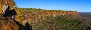
Waterberg Resort
The Waterberg Plateau, towering some 200 metres above the surrounding landscape, is one of the most spectacular features of the region.
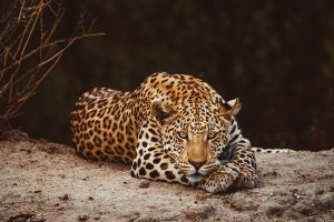
Okonjima Nature Reserve
The place where people and wildlife connect Okonjima Nature Reserve is equally famed for frequent leopard, brown hyena and pangolin sightings on its safaris, as well as the AfriCat Foundation. AfriCat’s mission has been to make significant contributions to conservation, while trying to ensure the survival of Namibia’s predators, endangered species and their natural habitat.
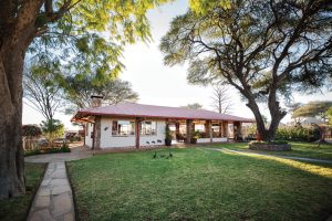
Dornhügel Guestfarm
In the North of Namibia, en route to the untouched Bushman country and the Zambezi Region, and only three hours away from the Etosha Pan lies our guest farm Dornhügel. We offer you a unique combination of a guest farm with a homely atmosphere, stylish ambience, and rustic farm life. Our eight spacious guestrooms are


